National Horse TrailPrint Page 
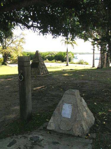
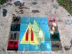
A small granite cairn erected in August 1977 to mark the beginning of the National Horse Trail from Cooktown to Melbourne, and the epic ride of Dan Seymour, who in the early 1970s demonstrated the feasibility of such a trail. The trail was mapped between 1974 and the 1980s, when it was made a bi-centennial project.
In 1950 Dan Seymour came to Australia broke, and for 20 years worked his way around the outback as a drover, ringer, dogger and fencer. It was around the rodeos that he met RM Williams and a great friendship developed. When RM proposed the National Trail, Dan volunteered to ride it. He left Ferntree Gully near Melbourne in February 1972 with two saddle horses, a pack horse and bluey. After riding the route of the Trail he returned to live in Dorrigo in northern NSW.
Location
| Address: | Charlotte Street, Cooktown, 4895 |
|---|---|
| State: | QLD |
| Area: | AUS |
| GPS Coordinates: | Lat: -15.463685 Long: 145.250063 Note: GPS Coordinates are approximate. |
Details
| Monument Type: | Monument |
|---|---|
| Monument Theme: | Culture |
| Sub-Theme: | Community |
Dedication
| Approx. Monument Dedication Date: | August-1977 |
|---|
THIS PLAQUE WAS ERECTED BY
A.T.H.R.A. TO MARK THE BEGINNING OF THE
NATIONAL HORSE TRAIL, AND TO
COMMEMORATE THE EPIC RIDE OF DAN
SEYMOUR FROM MELBOURNE TO COOKTOWN
WITH HIS TWO HORSES AND "BLUEY DOG." HE
BLAZED A TRAIL FOLLOWING THE GREAT
DIVIDING RANGE. THE TRAIL IS NOW
KNOWN AS THE NATIONAL TRAIL, SET
ASIDE FOR THOSE WHO WISH TO RIDE HORSES
FOR PLEASURE AND ENJOY OUR GREAT
AUSTRALIAN BUSH.
H TRANTER
AUGUST 1977
TABLELANDS TRAIL HORSRIDERS CLUB


