Home » Themes » Landscape » Settlement
Bicentennial National TrailPrint Page 
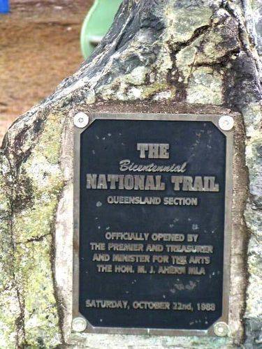
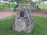
The monument marks the fact that Kilkivan is part of the Bicentennial National Trail from Healesville in Victoria to Cooktown in Queensland. Kilkivan is one of the few towns that the trail passes through.
The Bicentennial National Trail, over 5,000 kilometres from Healesville in Victoria to Cooktown in Queensland, is the longest marked route of its kind in the world; the 107-kilometre section through Kilkivan Shire mainly follows the forest ridges along the coastal ranges to the west of the highly populated plains of the Cooloola region. Here among the hills the trail follows many of the roads and tracks taken by the early pioneers.
The Trail committee proposed that the concept be made a project to celebrate Australia's Bicentenary in 1988. The suggestion was accepted, and funding of $300,000 was available to research, mark a route and print guidebooks. In November 1988, this had been accomplished and the Bicentennial National Trail was opened.
Location
| Address: | Wide Bay Highway (Bligh Street) , Lions Park , Kilkivan, 4600 |
|---|---|
| State: | QLD |
| Area: | AUS |
| GPS Coordinates: | Lat: -26.085771 Long: 152.239785 Note: GPS Coordinates are approximate. |
Details
| Monument Type: | Monument |
|---|---|
| Monument Theme: | Landscape |
| Sub-Theme: | Settlement |
Dedication
| Actual Monument Dedication Date: | Saturday 22nd October, 1988 |
|---|
The Bicentennial National Trail
Queensland Section
Officially opened by the Premier and Treasurer and Minister for the Arts the Hon. M.J.Ahern MLA
Saturday, October 22nd, 1988


