Home » Themes » Government » State
Opening of the Myponga ReservoirPrint Page 
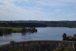
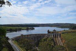
The monument commemorates the opening of the Myponga Reservoir in November 1962.
Location
| Address: | Reservoir Road, Myponga, 5202 |
|---|---|
| State: | SA |
| Area: | AUS |
| GPS Coordinates: | Lat: -35.399663 Long: 138.417857 Note: GPS Coordinates are approximate. |
Details
| Monument Type: | Monument |
|---|---|
| Monument Theme: | Government |
| Sub-Theme: | State |
| Actual Event Start Date: | 08-November-1962 |
| Actual Event End Date: | 08-November-1962 |
Dedication
| Actual Monument Dedication Date: | Wednesday 8th November, 1961 |
|---|
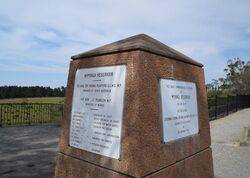
This tablet commemorating the opening of Mypong. Reservoir was unveiled by His Excellency Lieutenant-General Sir Edric Bastian K.C.M.G., K.B.E., C.B. Governor of South Australia on 8th November 1962
Myponga Reservoir
The Hon. Sir Thomas Playford G.C.M.G. M.P. Premier of South Australia
The Hon. G. Pearson M.P. Minister for Works
J. R. Dridan C. M. G. - - Engineer - in - Chief
N. M. Anderson - - Deputy Engineer - in - Chief
A. M. Campbell - - Engineer For Water Supply
W. G. J. Bates - - Engineer For Design
G. G. Poole O. B. E. - - Engineers for construction
G. E. F. Jacob
F. E. Ellis - - Engineer For Surveys
D. E. Martin - - Resident Engineers
G. R. A. Skinner
J. R. Wright - - Secretary
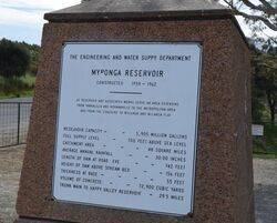
The Engineering and Water Suppy Department
Myponga Reservoir
Constructed 1958 - 1962
The reservoir and associated works serve an area extending from Yankalilla and Normanville to the Metropolitan Area and from the coastline to Willunga and McLaren Flat
Reservoir Capacity - - 5,905 Million Gallons
Full Supply Level - - 700 Feet Above Sea Level
Catchment Area - - - 49 Square Miles
Average Annual Rainfall - - 30.00 Inches
Length Of Dam At Road Eve - - 742 feet
Height Of Dam Above Stream Bed - - 156 feet
Thickness At Base - - - 55 feet
Volume Of Concrete - - 72,900 Cubic Yards
Trunk Main To Happy Valley Reservoir - 29.5 Miles


