www.monumentaustralia.org.au
Home » Themes » Landscape » Settlement
Pioneers of Myponga DistrictPrint Page 
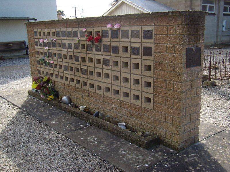
The wall commemorates the pioneers of the Myponga District. The wall was a Jubilee 150 project in 1986 and contains a series of plaques.
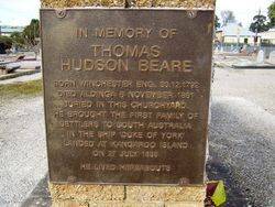
An afternoon of commemorative ceremonies took place amid some inclement weather at Myponga on Sunday. A plaque was unveiled on a wall in the Uniting Church cemetery by Chairman of the District Council of Yankalilla, Mr Peter Krichauff, as a memorial to pioneers of the Myponga district. This was then dedicated by Fr Ron Williams on behalf of Chairman of the Jubilee 150 Committee, Kym Bonython, and local minister, Fr John Magor. The Victor Harbor Band played at the unveiling ceremony before heavy rains forced people into the hall where it was completed. Another plaque was unveiled on the wall as a memorial to Mr Thomas Hudson Beare head of the first family to settle in South Australia, on Kangaroo Island, and later resident in Myponga in 1838. The plaque was unveiled by a decendant, Mr Bruce Williams, from the Kangaroo Island Pioneers Association on behalf of other descendants who were present.
The second ceremony was conducted on a vacant block of land in the main street where more than 200 people gathered. A trough made out of a red gum in the 1870's by Mr Reubin Eats was placed in the park by the District Council of Yankalilla. The trough was a memorial to Mr Tom Roberts in recognition of his community service to the district. Mr Bob Eats unveiled the plaque and Mr Tim Roberts, son of Tom Roberts, addressed the crowd. Mr Eats outlined the historyof the trough which has been used for many years on Clarkes Hill three miles west of Myponga where it was filled from a natural spring for horses travelling between Adelaide and Yankalilla. Descendants of Mr Reubin Eats were present at the unveiling ceremony.
Victor Harbour Times (SA), 8 October 1986.
View Google Map
An afternoon of commemorative ceremonies took place amid some inclement weather at Myponga on Sunday. A plaque was unveiled on a wall in the Uniting Church cemetery by Chairman of the District Council of Yankalilla, Mr Peter Krichauff, as a memorial to pioneers of the Myponga district. This was then dedicated by Fr Ron Williams on behalf of Chairman of the Jubilee 150 Committee, Kym Bonython, and local minister, Fr John Magor. The Victor Harbor Band played at the unveiling ceremony before heavy rains forced people into the hall where it was completed. Another plaque was unveiled on the wall as a memorial to Mr Thomas Hudson Beare head of the first family to settle in South Australia, on Kangaroo Island, and later resident in Myponga in 1838. The plaque was unveiled by a decendant, Mr Bruce Williams, from the Kangaroo Island Pioneers Association on behalf of other descendants who were present.
The second ceremony was conducted on a vacant block of land in the main street where more than 200 people gathered. A trough made out of a red gum in the 1870's by Mr Reubin Eats was placed in the park by the District Council of Yankalilla. The trough was a memorial to Mr Tom Roberts in recognition of his community service to the district. Mr Bob Eats unveiled the plaque and Mr Tim Roberts, son of Tom Roberts, addressed the crowd. Mr Eats outlined the historyof the trough which has been used for many years on Clarkes Hill three miles west of Myponga where it was filled from a natural spring for horses travelling between Adelaide and Yankalilla. Descendants of Mr Reubin Eats were present at the unveiling ceremony.
Victor Harbour Times (SA), 8 October 1986.
Location
| Address: | Main South Road & Hansen Street, Myponga Uniting Church Cemetery, Myponga, 5202 |
|---|---|
| State: | SA |
| Area: | AUS |
| GPS Coordinates: | Lat: -35.391792 Long: 138.463682 Note: GPS Coordinates are approximate. |
Details
| Monument Type: | Monument |
|---|---|
| Monument Theme: | Landscape |
| Sub-Theme: | Settlement |
Dedication
| Actual Monument Dedication Date: | Sunday 5th October, 1986 |
|---|
Right Side Inscription
Source: MAPlaque :
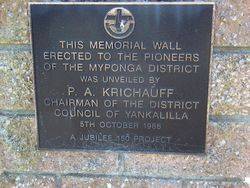
This Memorial Wall erected to the pioneers of the Myponga District was unveiled by P. A. Krichauf Chairman of the District
Council of Yankalilla
5th October 1986
A Jubilee 150 Project
Monument details supplied by Monument Australia - www.monumentaustralia.org.au


