50th Anniversary of the 1956 FloodPrint Page 

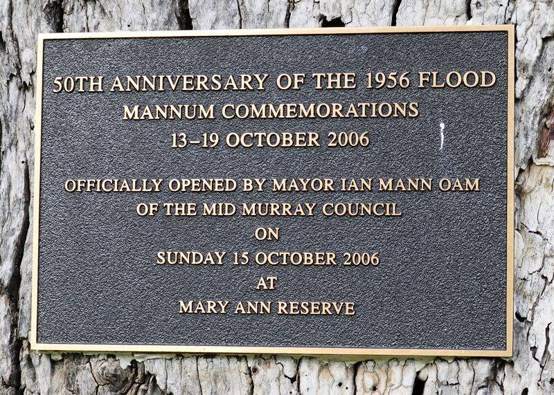
The plaque commemorates the 50th Anniversary Commemorations of the 1956 Flood which was held on the 13-19th October 2006.
The 1956 flood disaster affected many communities and townships along the Murray River with businesses and homes lost forever and Mannum was no exception. Although residents knew floodwaters were coming, no-one predicted the flood levels experienced. 100,000 sandbags were required for riverbanks in the Mannum area and emergency accommodation was provided in E&WS buildings at the show ground. By mid July the river had risen notably with the punt expected to operate for one more week only.
Floodwaters in Mannum's main street engulfed the lower green of the Mannum Bowing Club on August 3, with all greens covered the following week. The river rose two inches per day with the August 16 level of 120 feet eight inches expected to rise to 122 feet. The river was two feet six inches above the 1931 level of 3.5m.
Mannum Flood emergency kitchen ladies served over 1700 meals to flood volunteers in the town from the rear of the Commercial Bank and on Wednesday August 22 windy conditions resulted in the river level of 122.3 feet placing huge pressure on the bank protecting the lower section of the business area. Sandbagging, some six feet thick and within three feet of the top of the verandah posts in front of the Mannum Hotel held back seven feet of water.
The river continued to rise at a frightening rate of more than two inches per day and more than 700 volunteers assisted. Floodwater in Mannum peaked on the 9th September 1956 at 5.35m. Rowers could be seen rowing down the main street of Mannum and hotels continued to serve through their second storey balconies. It took months and months for the clean up and the ferry did not recommence operating until the 4th of February 1957.
Location
| Address: | River Lane , Mary Ann Reserve, Mannum, 5238 |
|---|---|
| State: | SA |
| Area: | AUS |
| GPS Coordinates: | Lat: -34.9156 Long: 139.311882 Note: GPS Coordinates are approximate. |
Details
| Monument Type: | Monument |
|---|---|
| Monument Theme: | Disaster |
| Sub-Theme: | Flood |
| Approx. Event Start Date: | 1956 |
| Approx. Event End Date: | 2006 |
Dedication
| Actual Monument Dedication Date: | Sunday 15th October, 2006 |
|---|
50th Anniversary of the 1956 Flood
Mannum commemorations
13 - 19 October 2006
Officially opened by Mayor Ian Mann OAM of the Mid Murray Council on Sunday 15 October 2006 at Mary Ann Reserve


